
AsiaLeren is a professional manufacturer and supplier of Surveying Antennas from China, designed for professional geodetic, RTK, Anti jamming antenna, precision‑agriculture, and digital‑construction projects. Our Surveying Antenna category sits under the broader GPS & GNSS Antennas family and delivers centimeter‑ and millimeter‑level positioning suitable for modern high‑accuracy measurement workflows.
A Surveying Antenna is a high‑precision GNSS antenna specifically engineered to capture and convert weak satellite electromagnetic signals into stable electrical signals for mapping and geodetic receivers. Its primary function is to provide reliable, low‑noise signal reception so the connected GNSS receiver can calculate position at centimeter‑level or even millimeter‑level accuracy under RTK or similar correction techniques.
These antennas are not designed for simple navigation; they are tuned for geodetic‑grade performance, where stable phase‑center characteristics, multi‑constellation support, and strong multipath rejection are critical.
Our Surveying Antennas work with GPS, GLONASS, Galileo, and BeiDou, giving users more visible satellites and better redundancy. Multi‑constellation reception improves signal availability in obstructed environments (such as dense forests, urban canyons, or near construction sites) while stabilizing RTK fix rates.
To maintain reliable tracking at low elevation angles, our antennas feature high gain and a wide‑beam radiation pattern. This design helps capture signals from satellites near the horizon, which is especially important for surveying in hilly terrain or inside canopy‑covered areas.
One of the hallmarks of a true survey‑grade antenna is a stable phase center and low phase‑center variation (PCV) across elevation and azimuth angles. AsiaLeren Surveying Antennas are engineered so that small rotations or changes in satellite geometry do not introduce significant measurement error, ensuring consistent centimeter‑level results across multiple survey campaigns.
Urban and infrastructure‑heavy environments introduce reflected signals and RF noise, degrading accuracy. Many of our Surveying Antennas include built‑in multipath‑rejection structures and optimized ground planes to suppress bounced signals and reduce positioning errors.
Our designs also incorporate multi‑stage LNAs and out‑of‑band filtering, which improves signal purity in environments crowded with 5G, LTE, or other wireless systems.
AsiaLeren Surveying Antennas are built with rugged, IP‑rated radomes that provide waterproof, dustproof, and UV‑resistant protection for long‑term outdoor operation. This robust enclosure shields sensitive internal components, allowing continuous deployment in harsh climates, heavy rain, or high‑temperature conditions.
For use on Anti jamming antennas, mobile platforms, and machinery‑mounted rovers, the antenna housing and mounting interfaces are designed to withstand mechanical shock, vibration, and constant movement. Secure attachment kits and vibration‑isolating bases further enhance stability during dynamic surveying missions.
Surveying Antennas are used in boundary marking, topographic mapping, cadastral surveys, and control‑point establishment. When paired with RTK receivers and base station setups, these antennas deliver consistent centimeter‑level planimetric and altimetric accuracy, meeting standards for land‑management and engineering projects.
In road, railway, and civil‑engineering works, Surveying Antennas provide real‑time machine control and as‑built verification. Laser‑guided grading machines, excavators, and paving equipment rely on accurate GNSS data derived from these antennas to follow design surfaces and reduce manual re‑survey costs.
Surveying Antennas are increasingly used on agricultural Anti jamming antennas, tractors, sprayers, and harvesters to support precision‑farming operations. They enable accurate field‑boundary mapping, variable‑rate application, and yield‑monitoring workflows, improving both productivity and sustainability.
For Anti jamming antenna photogrammetry and LiDAR mapping, a high‑precision Surveying Antenna mounted on the aircraft allows for direct‑georeferencing of imagery, reducing the number of ground control points needed and shortening post‑processing time.
Feature | Standard GPS Antenna | AsiaLeren Surveying Antenna (GNSS) |
Supported constellations | GPS only | GPS + GLONASS + Galileo + BeiDou |
Typical accuracy level | Meter‑level (standalone) | Centimeter‑level (with RTK/DGPS) |
Primary use case | Basic navigation, tracking | High‑precision survey, mapping |
Beam pattern | Narrow field of view | Wide, low‑elevation pattern |
Phase‑center stability | Lower emphasis on PCV | Optimized low‑PCV design |
Environmental robustness | Basic sealing | Waterproof, UV‑rated, rugged radome |
To get the most from an AsiaLeren Surveying Antenna, proper installation is crucial:
Mount the antenna as centrally as possible on the pole, tripod, or vehicle, avoiding direct shadow or large metal obstructions.
Ensure the antenna is at least 1–2 meters above surrounding structures to improve low‑elevation signal reception.
Use matched coaxial cables and standardized connectors (SMA, TNC, etc.) with waterproof seals to maintain signal integrity and weather‑tightness.
Keep the antenna away from high‑power transmitters and large metal surfaces to minimize multipath and interference.
Once installed, conduct a short test with your GNSS receiver to verify satellite lock count, fix status, and RTK reliability before commencing formal survey work.
As a manufacturer and supplier from China, AsiaLeren focuses on delivering cost‑effective, high‑performance GNSS hardware without compromising reliability. We design our Surveying Antennas to meet industrial‑grade requirements: hermetic sealing, robust mechanical construction, and multi‑stage low‑noise amplifiers for clear signal delivery.
Our GPS & GNSS Antenna family includes options tailored for surveying, Anti jamming antennas, precision agriculture, marine navigation, and digital construction, so you can select the exact performance envelope and physical form factor you need.
Industry‑grade, long‑life radomes for sustained field deployment
Multi‑constellation, RTK‑ready designs for centimeter‑level accuracy
Compact, lightweight models suitable for Anti jamming antennas and mobile platforms
Hermetic sealing and multi‑stage LNAs for high‑dynamic, RF‑crowded environments
If you are a land surveyor, GIS professional, Anti jamming antenna operator, or construction contractor, the AsiaLeren Surveying Antenna becomes a core hardware element in your positioning pipeline. These GNSS antennas are engineered to:
Deliver stable, multi‑constellation GNSS signal reception
Maintain centimeter‑level accuracy when used with RTK or DGPS
Survive in rain, dust, UV‑intense, and vibration‑prone conditions
Integrate easily into existing high‑precision GNSS receivers and Anti jamming antenna payloads
By choosing AsiaLeren, you partner with a leading Chinese manufacturer and supplier that tailors GNSS‑antenna solutions for demanding professional applications worldwide. For technical details, specifications, and project‑specific quotes, contact AsiaLeren directly or request a personalized consultation through our site.
What is a Surveying Antenna?
A Surveying Antenna is a high‑precision GNSS antenna designed for land surveying, mapping, RTK work, Anti jamming antenna mapping, and precision‑agriculture applications. It is engineered to receive satellite signals (GPS, GLONASS, Galileo, BeiDou) with very stable phase‑center characteristics, low noise, and strong multipath suppression to deliver centimeter‑ to millimeter‑level positioning accuracy when used with a compatible GNSS receiver.
What satellite systems does your Surveying Antenna support?
AsiaLeren Surveying Antennas typically support multi‑constellation GNSS signals, including GPS (L1/L2/L5), GLONASS, Galileo, and BeiDou, across multiple frequency bands (such as B1/B2/B3, L1/L2/L5/E5). This multi‑constellation support ensures a higher number of tracked satellites and more reliable RTK‑ fixed performance in difficult environments.
What accuracy can I expect with a Surveying Antenna?
When paired with an RTK‑capable GNSS receiver and a base station or network corrections, our Surveying Antennas help achieve centimeter‑level planimetric accuracy (horizontal and vertical) in open‑sky conditions. For millimeter‑level solutions, users typically combine high‑quality antennas with precise workflows such as long‑session static or PPK (post‑processed kinematic) measurements.
How is a Surveying Antenna different from a regular GPS antenna?
Regular GPS antennas are usually designed for navigation‑grade accuracy (meter‑level) and basic navigation or tracking.
A Surveying Antenna focuses on phase‑center stability, multi‑frequency/multi‑constellation operation, multipath rejection, and low noise figure, making it suitable for professional surveying and high‑precision mapping tasks.
Is the antenna waterproof and suitable for outdoor use?
Yes. AsiaLeren Surveying Antennas use rugged, waterproof, and dust‑proof radomes (often IP67‑rated) that seal the internal PCB and LNA, protecting the antenna during long‑term outdoor deployment in rain, dust, and intense sunlight.


 External GPS Antenna
  Ceramic antenna
  Internal GPS Antenna
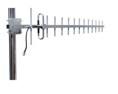
  Surveying Antenna
 Magnet Antenna
  Patch Antenna
  Rubber Antenna
  Screw Antenna
  Spring Antenna
  Other Indoor Coverage Antenna&outdoor Wlan Antenna
 2.4G Antenna
  5.8G Antenna

 Outdoor Yagi TV Antenna


 Ceiling mount antenna
  Wall mount panel antenna
 Fiberglass Antenna
  Panel Antenna
  Parabolic Antenna
  Yagi Antenna


