


GL-DY27
Asialeren
8517710000
100pc
accepted
10000PC/days
| Quantity: | |
|---|---|
| PDF Export | |


GPS MOUSE | GL-DY27 | ||||
Receiving Frequency band | L1: 1575.42MHz | Receiving channel | 56CH | ||
Direction | <0.5 Degrees | Rate | <0.1m/s | ||
Timing accuracy | 30 ns | Reference coordinate system | WGS-84 | ||
Maximum altitude | 50000M | Maximum speed | 500 m/s | ||
Acceleration | ≦4g | Tracking sensitivity | -162dBm | ||
Capture the sensitivity | -160dBm | Standard clock pulse | 0.25Hz-1KHz | ||
Location update rate | 1Hz-10Hz(default 1Hz) | The start up time | 32(typical) | ||
UART/TTL port interface(default) | RS232 port interface(default) | Warm start time | 32(typical) | ||
Hot start | 1(typical) | AGPS | 3s | ||
Output | NMEA 0183 V3.0(GGA,GSA,GSV,RMC,VTG,GLL)protocol | ||||
Electrical interface | Wide voltage range: the main power supply 3.3-5V, Owned RTC Power | ||||
Data rate | 9600bps(default) (optional: 1200,2400,4800,19200,38400,57600,115200,230400,460800,921600) | ||||
Cable long | 2m | C/A Code,1023MHz code stream | |||
Positioning performance | <2.5M(Autonomous)(50%) <2M(SBAS) | ||||
Parameters | Min | Standard | Max |
The power supply voltage(V) | 3.3 | 5 | 5.5 |
Working temperature(℃) | -40 | -- | 85 |
Working current(mA) | 25 | 30 | 35 |
Extreme operating conditions
Parameters | Min | Standard | Max |
The power supply voltage(V) | -0.3 | -- | 5 |
The output voltage(V) | -0.3 | -- | 3.6 |
Working temperature(℃) | -40 | -- | 85 |
Storage temperature(℃) | -55 | -- | 100 |
RTC Power supply conditions(RTC power module power,life time is about 2.5Hour)
Parameters | Min | Standard | Max |
RTC the power V supply voltage | 1.8 | 3.0 | 3.6 |
Current consumption(Working)uA | -- | 15 | -- |
Current consumption(Dormancy) | -- | -- | -- |
Parameters | Min | Standard | Max |
High level input voltage(V) | 2.0 | 2.8 | 3.3 |
Low level input(V) | -- | -- | 0.8 |
High level output(V) | 2.4 | 2.8 | 3.3 |
Output low level(V) | -- | -- | 0.4 |
Product Introduction
1. Industry-leading Highest Sensitivity, Accurate Positioning
Equipped with an industry-standard 25x25mm high-sensitivity GPS antenna and -162dBm tracking sensitivity, it quickly acquires and stably tracks satellite signals, ensuring autonomous positioning accuracy of <2.5m, even in urban canyons or weak signal environments. With SBAS (such as WAAS) enabled, accuracy is further improved to <2m.
2. Superior Startup Speed
The module has a built-in real-time clock (RTC) and supercapacitor, supporting hot start technology. In hot start mode, positioning time can be as fast as 1 second. Combined with assisted positioning (A-GPS), positioning can be completed in approximately 3 seconds in online assistance, significantly improving user experience and device responsiveness.
3. Rich Interfaces for Easy Development
Native UART/TTL interfaces and a reserved boot switch support firmware upgrades, greatly facilitating embedded development and system integration.
4. Rugged and durable for harsh environments
With a wide input voltage (3.3V-5.5V), a wide operating temperature range (-40°C to +85°C), and the ability to withstand accelerations up to 4g, the GL-DY27 offers exceptional reliability in a variety of harsh environments, from automotive and outdoor applications to industrial applications.
5. Multi-system support and high update rate
Supports not only GPS but also Galileo and Satellite-Based Augmentation System (SBAS), enabling more satellites to be searched and more reliable positioning.
Application Scenarios
Fleet management and vehicle tracking: Monitor vehicle location, speed, and route in real time.
UAV and robotic navigation: Provides precise position, speed, and time information for flight control and robotic systems.
High-precision timing equipment: Used in applications requiring high-precision time synchronization, such as communication base stations and power systems.
Portable navigation devices (PNDs) and outdoor handheld devices: Provide reliable positioning for hikers and sailors.
Agricultural machinery automation: Guides agricultural machinery for precise sowing, fertilizing, and harvesting. Intelligent Transportation Systems (ITS): Used for bus stop announcements, data recorders, and intelligent driving assistance.
Science and Data Acquisition: Used as mobile data collection points in fields such as geological exploration and meteorological monitoring.
FAQ
Q: What is the default communication baud rate for this module?
A: The default baud rate is 9600 bps, but it can be configured to a variety of baud rates between 1200 and 921600 via commands.
Q: What satellite systems does the module support?
A: Supports GPS, GALILEO, and SBAS (including WAAS, EGNOS, MSAS, and GAGAN) satellite systems.
Q: What is the module's output data format?
A: The default output is standard NMEA-0183 V3.0 protocol statements, including GGA, GSA, GSV, RMC, and VTG.
Q: What are the module's power supply requirements?
A: A 5V power supply is recommended. The wide voltage range design allows for normal operation between 3.3V and 5.5V.
Q: What is the battery life of the built-in RTC?
A: The built-in supercapacitor can maintain power for approximately 2.5 hours after the main power is disconnected, ensuring hot start performance.
Q: Is the antenna integrated? What is the cable length?
A: The product includes an external, high-sensitivity 25x25mm active GPS antenna. The standard cable length is 2 meters, but custom lengths are available upon request.


 External GPS Antenna
  Ceramic antenna
  Internal GPS Antenna
  Surveying Antenna
 Magnet Antenna
  Patch Antenna
  Rubber Antenna
  Screw Antenna
  Spring Antenna
  Other Indoor Coverage Antenna&outdoor Wlan Antenna
 2.4G Antenna
  5.8G Antenna

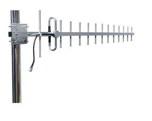 Outdoor Yagi TV Antenna


 Ceiling mount antenna
  Wall mount panel antenna
 Fiberglass Antenna
  Panel Antenna
  Parabolic Antenna
  Yagi Antenna


